
Visitez Hkakabo Razi
Informations utiles sur les stations afin de vous aider à planifier votre voyage à %{resort_name}.
- Ouverture de la saison—
- Fermeture de la saison—
- Hébergement—
- Restaurants | Bars— | —
- Aéroport le plus proche Rangoon
- Gare la plus proche —
- Site Officiel du Tourisme
- Tél. Office de Tourisme—
Hkakabo Razi Caractéristiques
Le terrain de Hkakabo Razi inclut :
- Halfpipes—
- Snowpark—
- Ski de fond—
- Location de skis—
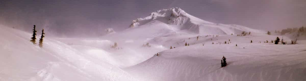
What's it like at Hkakabo Razi?
Hkakabo Razi is the highest mountain in Myanmar at 19,294 feet (5,881 metres and Myanmar was, until 1987, known as Burma.) The summit tip borders Tibet and India, also. The mountain is an extension of the Eastern Himalayas. Although low in comparison with Himalayan giants, Hkakabo Razi is perennially snow capped. Hkakabo Razi lies in the Hkakabo Razi protected area, established in 1996 which covers over 3812 square kilometres. Before 1993 this area was not accessable to foreigners. The first recorded attempt at the peak was made in 1995 by Takashai Ozaki, from Japan. He failed due to persistent bad weather. A year later he returned, and this time succeeded. Nyama Gyaltsen from Myanmar made it too. Like the main Himalayas, these mountains are heavily affected by the monsoon. Hkakabo Razi is certainly not a walk up. Huge cliffs with D+ climbing, hanging glaciers with large crevasses, and cornices, makes it a mountain not to be toyed with. The approach to the mountain is a major obstacle: there are unstable bridges, over huge gorges. For the most part, journeys are made on foot along footpaths that hug the mountainside and wind through dense jungle undergrowth. Ozaki demands four weeks walking to approach the base camp above 3000m/10000ft.
Découvrez la carte de la station de ski de Hkakabo Razi
Plan des pistes et plan des sentiers interactifs de Hkakabo Razi. Visualisez les pistes et les sentiers ainsi que le terrain environnant et les contours des montagnes pour pré&parer des activités dans toute la région. Trouvez et comparez les stations à proximité en cliquant sur les marqueurs de station.

Quel est le mois le plus enneigé pour aller à Hkakabo Razi ?
Comment est actuellement la neige à Hkakabo Razi?
Un résumé des conditions d'enneigement actuelles à Hkakabo Razi. Afficher de plus amples informations sur Hkakabo Razi page du rapport d'enneigement détaillé.
- État de la piste—
- État hors piste—

| Profondeur de Neige en Haut: | ||
|---|---|---|
| Profondeur de Neige en Bas: | ||
Commentaires de Visiteurs de Hkakabo Razi
Roger de Canada écrit:
There was a plan to build a resort on this mountain led by former billionaire Thai Prime Minister Taksin. Of course, nothing came of it because it probably made little sense.
Lisez 2 autres commentaires de Hkakabo Razi ou soumettez le votre
Stations proches de Hkakabo Razi
Découvrez les stations de ski proches de Hkakabo Razi. Cliquez ci-dessous pour consulter les guides des stations de ski.
 Auli
Auli Changchengling Ski Resort
 Nearest