Brandnertal (Brand und Bürserberg)at 2000 m altitude
Publié par Snow-Forecast.com sur :7 am (heure locale) / 15 Jul 2026
Derniers 6 joursFaites défiler vers la gauche pour les derniers 6 joursMaintenant
Next 3 days weather summary:
Forte pluie (total 46.0mm), la plus forte pendant le mer. soir. Très doux (max 19°C le jeu. après-midi, min 10°C le mer. soir). Le vent sera généralement faible.
Jours 4-6 Brandnertal (Brand und Bürserberg) Résumé Météo
Forte pluie (total 30.0mm), la plus forte pendant le dim. soir. Très doux (max 13°C le sam. après-midi, min 6°C le dim. soir). Le vent sera généralement faible.
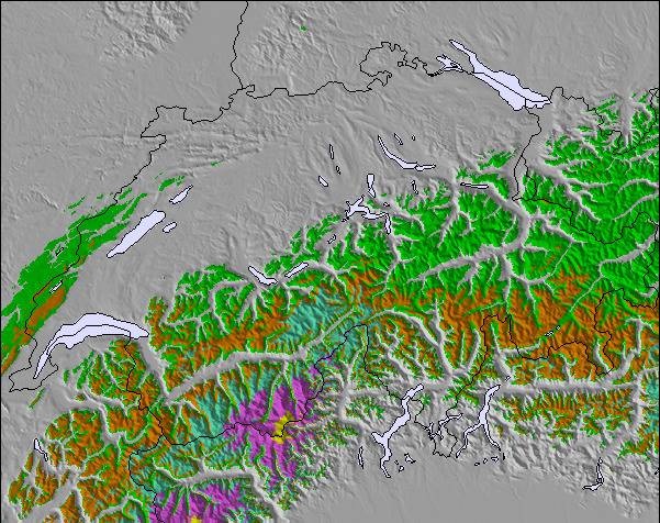
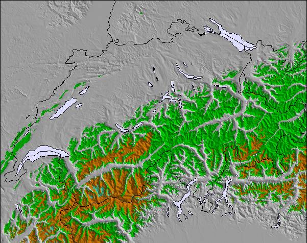
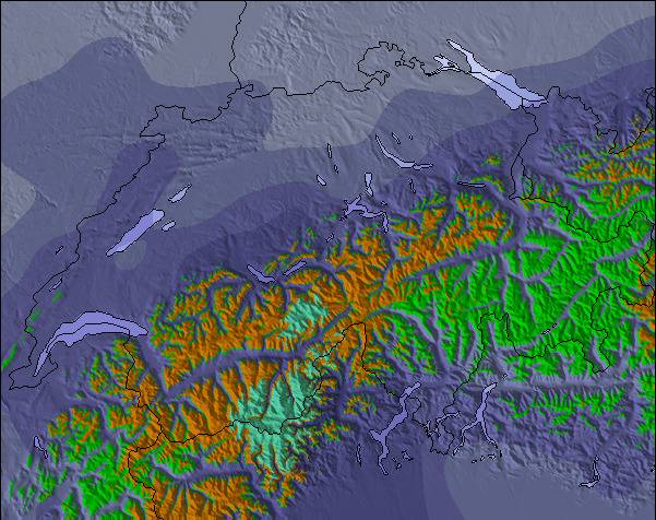
Le tableau ci-dessus montre les prévisions météo pour Brandnertal (Brand und Bürserberg) à l'altitude spécifique de 2000 m. Notre modèle de prévisions météo sophistiqué nous permet de donner des prévisions de neige en bas, au milieu et en haut de la station Brandnertal (Brand und Bürserberg). Pour accéder aux prévisions météo à d'autres altitudes, utiliser l'onglet de navigation au-dessus du tableau. Pour une vue d'ensemble du temps, référez-vous à , la Carte Météo de Austria.
Cliquez ici Pour lire les informations supplémentaires sur les niveaux de gel et comment nous prévoyons les températures.
Le nom de la station s'écrit également Brandnertal.
Commentaires de Visiteurs de Brandnertal (Brand und Bürserberg)
Globalement 4.1 Basé sur 14 votes et 3 commentaires
I first came here 25 years ago as a 12 year old boy with my father. I have now returned with my daughter who is only 3 and skiing for the first time. Brand is a superb little Austrian resort with fantastic facilities for children. We stayed at the 4 star Sporthotel Beck which has a excellent kids club and is part of the Kinder hotels group. With a nursery slope in the village, horse riding, sledging, quad biking and an excellent kids club. Brand is ideal for beginners and intermediate skiers. There are a some good apres bars and some nice restaurants, but don't come here for mad apres-ski as you wont find it - head to St Anton or Ischgl for that. Although like many resorts in Austria the village is quite low we had plenty of snow and some great powder days. So if you are a first time skier or are taking the kids and are looking for a quaint little Austrian resort - head to Brandnertal.
Commentaires de Visiteurs de Brandnertal (Brand und Bürserberg)
Globalement: 4.1 Basé sur 14 votes et 3 commentaires
Fiabilité (neige)
3.9
Variété de pistes
3.9
Hors-piste
3.0
Paysages
4.7
Après-Ski
3.3
Shane de United Kingdom écrit:
I first came here 25 years ago as a 12 year old boy with my father. I have now returned with my daughter who is only 3 and skiing for the first time. Brand is a superb little Austrian resort with fantastic facilities for children. We stayed at the 4 star Sporthotel Beck which has a excellent kids club and is part of the Kinder hotels group. With a nursery slope in the village, horse riding, sledging, quad biking and an excellent kids club. Brand is ideal for beginners and intermediate skiers. There are a some good apres bars and some nice restaurants, but don't come here for mad apres-ski as you wont find it - head to St Anton or Ischgl for that. Although like many resorts in Austria the village is quite low we had plenty of snow and some great powder days. So if you are a first time skier or are taking the kids and are looking for a quaint little Austrian resort - head to Brandnertal.
Widget Snow-Forecast.com gratuit pour votre site web
Le widget météo de ski Brandnertal (Brand und Bürserberg) est intégré gratuitement sur les sites Web externes. Il fournit un résumé quotidien de nos prévisions d'enneigement de Brandnertal (Brand und Bürserberg) et des conditions météo actuelles. Il vous suffit d'aller sur la page de configuration et de suivre les 3 étapes simples pour récupérer le code html personnalisé et le coller dans votre propre site. Vous pouvez choisir l'altitude des prévisions d'enneigement (au sommet, à mi-montagne ou en bas des pistes) et les unités métriques/impériales pour saisir des prévisions d'enneigement en fonction de votre propre site Web…. Cliquez ici pour obtenir le code.


 Nearest