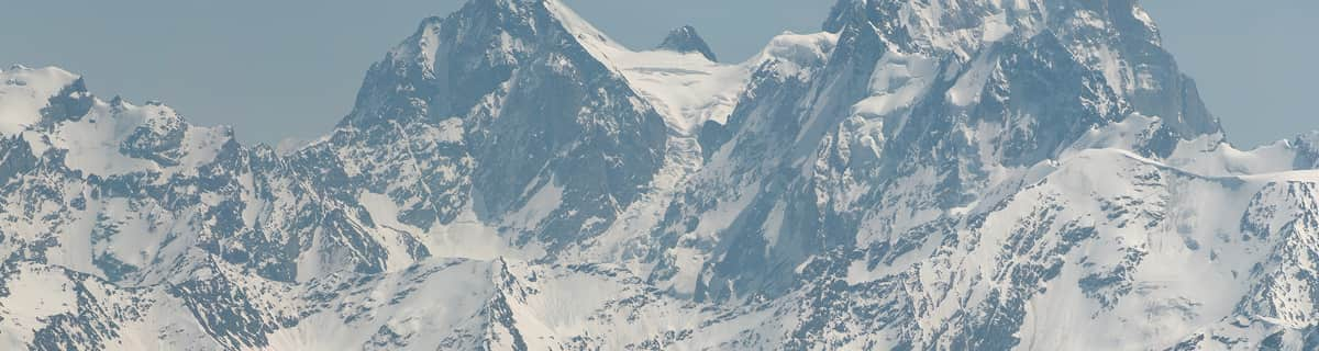


Portillo Re-Opens To Guests Arriving By Helicopter
Chile’s famous Portillo ski resort is reported to have re-opened to guests arriving by helicopter after being cut off by road for more than two weeks by over 6m/20 feet of snowfall.

Next 3 days weather summary:Pluie modérée (total 19.0mm), la plus forte le mer. soir. Chaud (max 26°C le lun. après-midi, min 16°C le mar. soir). Le vent sera généralement faible. | Jours 4-6 Brandnertal (Brand und Bürserberg) Résumé MétéoForte pluie (total 35.0mm), la plus forte pendant le jeu. soir. Chaud (max 21°C le jeu. après-midi, min 13°C le jeu. soir). Le vent sera généralement faible. | ||||||||||||||||
lun 3 | mardi 4 | mercredi 5 | jeudi 6 | vendredi 7 | samedi 8 | ||||||||||||
après-midi | soir | matin | après-midi | soir | matin | après-midi | soir | matin | après-midi | soir | matin | après-midi | soir | matin | après-midi | soir | |
nuageux | averses | beau | qq nuages | averses | beau | risque orage | averses | risque orage | risque orage | forte pluie | risque orage | risque orage | averses | beau | nuageux | beau | |
km/h | |||||||||||||||||
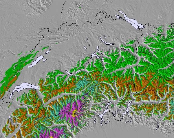
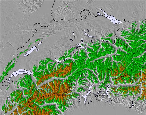
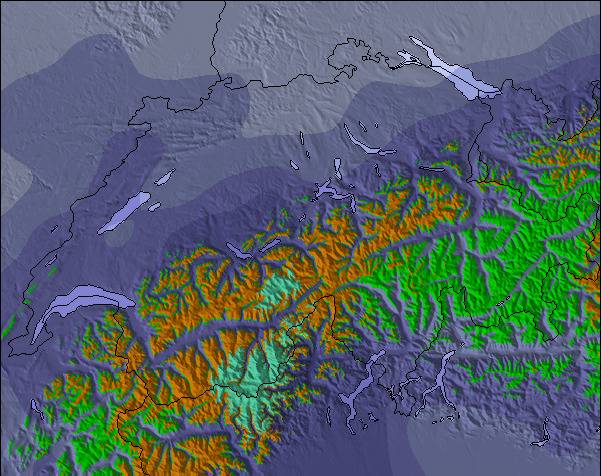
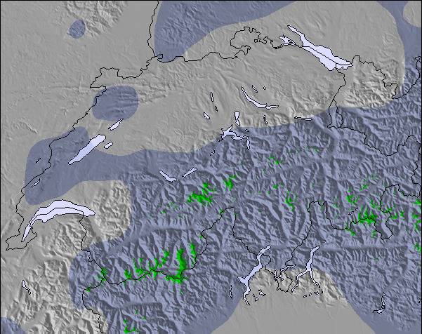
Carte neige |  |  |  |  |  |  | |||||||||||
— | — | — | — | — | — | — | — | — | — | — | — | — | — | — | — | — | |
mm | — | 1 | — | — | 3 | — | 3 | 11 | 1 | 7 | 24 | 1 | 2 | 1 | — | — | — |
max °C | 26 | 23 | 24 | 26 | 23 | 20 | 23 | 20 | 20 | 21 | 14 | 15 | 16 | 16 | 17 | 19 | 18 |
min °C | 23 | 20 | 21 | 25 | 16 | 17 | 22 | 18 | 18 | 20 | 13 | 13 | 16 | 14 | 14 | 19 | 16 |
chill °C | 23 | 20 | 21 | 25 | 16 | 17 | 22 | 18 | 18 | 20 | 13 | 13 | 16 | 14 | 14 | 19 | 16 |
Humid. % | 44 | 52 | 40 | 36 | 83 | 61 | 59 | 72 | 63 | 65 | 88 | 85 | 78 | 77 | 68 | 63 | 69 |
Niveau de gel m | 4550 | 4450 | 4450 | 4600 | 4400 | 4400 | 4450 | 4300 | 4250 | 4300 | 3800 | 3950 | 3950 | 4100 | 4050 | 4100 | 4350 |
— | — | 6:01 | — | — | 6:03 | — | — | 6:05 | — | — | 6:05 | — | — | 6:07 | — | — | |
— | 8:52 | — | — | 8:50 | — | — | 8:49 | — | — | 8:46 | — | — | 8:45 | — | — | 8:44 | |
Devenez pro et carve en:
Informations avalanche : European Avalanche Warning Services (EAWS)
Derniers bulletins d'enneigement près de Brandnertal (Brand und Bürserberg):
| Épaisseur de neige au sommet : | 0 cm |
|---|---|
| Épaisseur de neige en bas : | 0 cm |
| Épaisseur de neige fraîche : | — |
| Dernières chutes de neige : | 16 May 2026 |
0.0 | Journées poudreuse Bluebird Neige fraîche, plutôt ensoleillé, vent faible. |
|---|---|
0.0 | Journées poudreuse Neige fraîche, peu ensoleillé, vent éventuel. |
0.0 | Journées Bluebird Neige moyenne, plutôt ensoleillé, vent faible. |
Le tableau ci-dessus montre les prévisions météo pour Brandnertal (Brand und Bürserberg) à l'altitude spécifique de 1446 m. Notre modèle de prévisions météo sophistiqué nous permet de donner des prévisions de neige en bas, au milieu et en haut de la station Brandnertal (Brand und Bürserberg). Pour accéder aux prévisions météo à d'autres altitudes, utiliser l'onglet de navigation au-dessus du tableau. Pour une vue d'ensemble du temps, référez-vous à , la Carte Météo de Austria.
Cliquez ici Pour lire les informations supplémentaires sur les niveaux de gel et comment nous prévoyons les températures.
Le nom de la station s'écrit également Brandnertal.
Globalement 4.1 Basé sur 14 votes et 3 commentaires
This is a fantastic family resort. We ski all over Europe with our 3 children and we come back to this resort at least once a year (for the last 10 years). It's quiet, it's got a lot of very good runs and it's good value (not cheap but you get value for money). The snow fall is reliable and frequent. If you want nightlife go to St Anton. Come here if you want a great week of skiing in a friendly well run clean safe resort with good lifts and decent mountain restaurants which will not bankrupt you go to Brand
Mike SHAW de United Kingdom écrit:
This is a fantastic family resort. We ski all over Europe with our 3 children and we come back to this resort at least once a year (for the last 10 years). It's quiet, it's got a lot of very good runs and it's good value (not cheap but you get value for money). The snow fall is reliable and frequent. If you want nightlife go to St Anton. Come here if you want a great week of skiing in a friendly well run clean safe resort with good lifts and decent mountain restaurants which will not bankrupt you go to Brand
Lisez 2 autres commentaires de Brandnertal (Brand und Bürserberg) ou soumettez le votre

 Nearest