

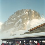
America’s Next Indoor Snow Centre Takes Shape
Construction of a new indoor snow centre for skiers, boarders and tubers appears to be making good progress at Heritage Farm in Wayne County, West Virginia.

Next 4 days weather summary:Pluie légère (total 6.0mm), généralement en baisse le dim. soir. Températures douces (max 9°C le lun. après-midi, min 6°C le mar. matin). Le vent sera généralement faible. | Jours 5-7 Meiringen-Hasliberg Résumé MétéoPluie légère (total 3.0mm), généralement en baisse le jeu. après-midi. Très doux (max 12°C le sam. après-midi, min 5°C le jeu. matin). Le vent sera généralement faible. | |||||||||||||||
lundi 20 | mardi 21 | mercredi 22 | jeudi 23 | vendredi 24 | ||||||||||||
soir | matin | après-midi | soir | matin | après-midi | soir | matin | après-midi | soir | matin | après-midi | soir | matin | après-midi | soir | |
averses | beau | risque orage | averses | qq nuages | averses | beau | beau | beau | qq nuages | qq nuages | averses | averses | beau | beau | beau | |
km/h | ||||||||||||||||
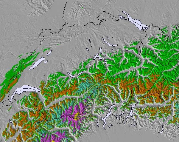
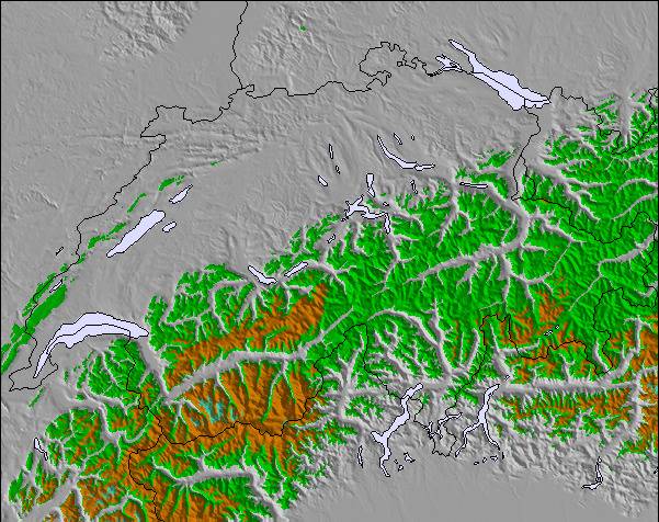
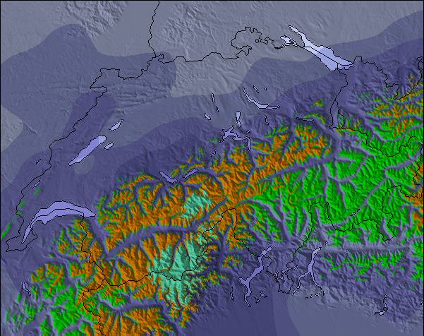
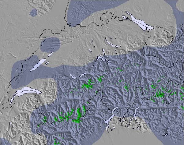
Carte neige |  |  |  |  |  |  | ||||||||||
— | — | — | — | — | — | — | — | — | — | — | — | — | — | — | — | |
mm | 1 | — | 2 | 1 | — | 2 | — | — | — | — | — | 2 | 1 | — | — | — |
max °C | 7 | 8 | 9 | 8 | 7 | 7 | 7 | 9 | 9 | 8 | 6 | 7 | 6 | 9 | 10 | 10 |
min °C | 7 | 7 | 9 | 7 | 6 | 7 | 6 | 7 | 9 | 6 | 5 | 7 | 5 | 7 | 10 | 9 |
chill °C | 6 | 5 | 8 | 4 | 4 | 5 | 5 | 6 | 8 | 4 | 2 | 5 | 3 | 6 | 10 | 8 |
Humid. % | 74 | 73 | 81 | 58 | 67 | 77 | 43 | 31 | 59 | 54 | 66 | 73 | 39 | 21 | 44 | 38 |
Niveau de gel m | 3650 | 3550 | 3600 | 3800 | 3450 | 3300 | 3650 | 3800 | 3600 | 3450 | 3150 | 3200 | 3700 | 4050 | 3900 | 4000 |
— | 5:52 | — | — | 5:52 | — | — | 5:54 | — | — | 5:56 | — | — | 5:56 | — | — | |
— | — | — | 9:13 | — | — | 9:12 | — | — | 9:10 | — | — | 9:09 | — | — | 9:08 | |
Devenez pro et carve en:
Informations avalanche : European Avalanche Warning Services (EAWS)
Derniers bulletins d'enneigement près de Meiringen-Hasliberg:
| Épaisseur de neige au sommet : | 0 cm |
|---|---|
| Épaisseur de neige en bas : | 0 cm |
| Épaisseur de neige fraîche : | — |
| Dernières chutes de neige : | 18 May 2026 |
0.0 | Journées poudreuse Bluebird Neige fraîche, plutôt ensoleillé, vent faible. |
|---|---|
0.0 | Journées poudreuse Neige fraîche, peu ensoleillé, vent éventuel. |
0.0 | Journées Bluebird Neige moyenne, plutôt ensoleillé, vent faible. |
Le tableau ci-dessus montre les prévisions météo pour Meiringen-Hasliberg à l'altitude spécifique de 2432 m. Notre modèle de prévisions météo sophistiqué nous permet de donner des prévisions de neige en bas, au milieu et en haut de la station Meiringen-Hasliberg. Pour accéder aux prévisions météo à d'autres altitudes, utiliser l'onglet de navigation au-dessus du tableau. Pour une vue d'ensemble du temps, référez-vous à , la Carte Météo de Switzerland.
Cliquez ici Pour lire les informations supplémentaires sur les niveaux de gel et comment nous prévoyons les températures.
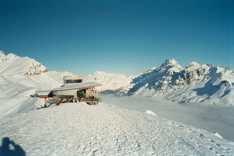
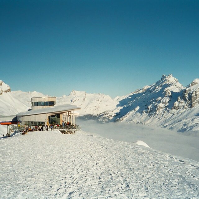
Le nom de la station s'écrit également Meiringen.
Globalement 4.1 Basé sur 14 votes et 3 commentaires
Stayed here 26Dec/3 nights at the Hotel Victoria, in Meiringen. Enjoyed my stay here very much and 2 days on the slopes was enough here to cover the area. Great views, conditions, good runs, lifts. Being a snowboarder though there were too many flat spots for my liking and the lifts were a bit spread out meaning walking between lifts sometimes. Traditional resort, Swiss charm, had some sort of bell ringing tradition going on every night we were there. Enjoyed it but will probably try other resorts in the future and unlikely to go back here as a lot of other resorts in Switzerland to try!
christian de United Kingdom écrit:
Stayed here 26Dec/3 nights at the Hotel Victoria, in Meiringen.
Enjoyed my stay here very much and 2 days on the slopes was enough here to cover the area. Great views, conditions, good runs, lifts.
Being a snowboarder though there were too many flat spots for my liking and the lifts were a bit spread out meaning walking between lifts sometimes.
Traditional resort, Swiss charm, had some sort of bell ringing tradition going on every night we were there. Enjoyed it but will probably try other resorts in the future and unlikely to go back here as a lot of other resorts in Switzerland to try!
Lisez 2 autres commentaires de Meiringen-Hasliberg ou soumettez le votre

 Nearest