
Visitez Ruwenzori
Informations utiles sur les stations afin de vous aider à planifier votre voyage à %{resort_name}.
- Ouverture de la saison—
- Fermeture de la saison—
- Hébergement—
- Restaurants | Bars— | —
- Aéroport le plus proche —
- Gare la plus proche —
- Site Officiel du Tourisme
- Tél. Office de Tourisme—
Ruwenzori Caractéristiques
Le terrain de Ruwenzori inclut :
- Halfpipes—
- Snowpark—
- Ski de fond—
- Location de skis—
What's it like at Ruwenzori?
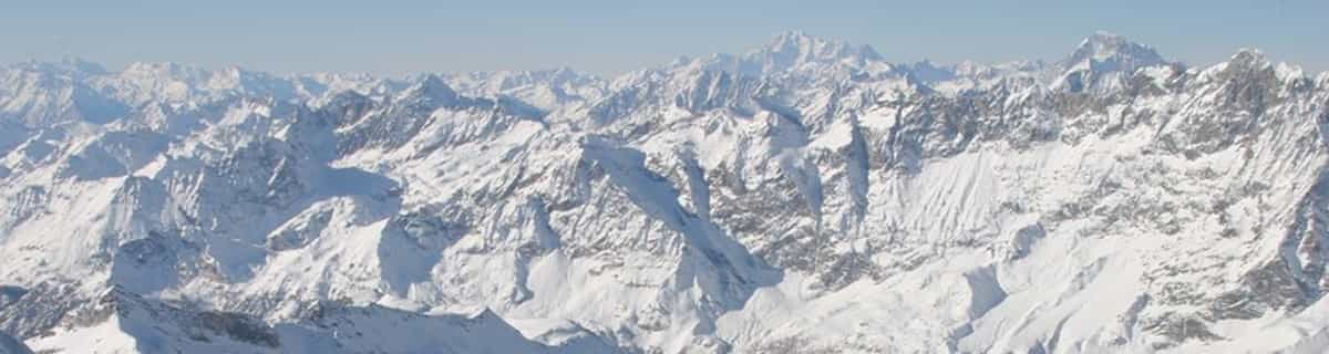
The Ruwenzori is a group of six high glaciated massifs, located in a small remote area between Lake Edward and Lake Albert on the border between Uganda and Zaire. This is part of the African Lake District, west of the Great Rift Valley. The massifs are all topped with several icy summits and are deeply divided by narrow 3,000-foot gorges. The complex is surrounded by a wide belt of boggy foothills, guarding the mountains with an approach through knee-deep mud and practically impassable vegetation. These conditions, coupled with frequent bad weather, saved Ruwenzori from exploration until well after the rest of East Africa had already been explored. In 150 AD, the distinguished geographer Claudius Ptolemy produced an early map of Africa on which a group of mountains just south of the equator were identified as Lunae Montes, or 'Mountains of the Moon'. They were shown to be an important water source, and were subsequently believed to be the source of the Nile. Although Kilimangaro and Kenya have been postulated as the mountains to which Ptolemy referred, it is widely held that the Ruwenzori Mountains are indeed the 'Mountains of the Moon'. The Zaire side is part of the Virunga National Park. Accommodations here are better than on the Uganda side, where mountain huts exist but are mostly run down and unsanitary.
Découvrez la carte de la station de ski de Ruwenzori
Plan des pistes et plan des sentiers interactifs de Ruwenzori. Visualisez les pistes et les sentiers ainsi que le terrain environnant et les contours des montagnes pour pré&parer des activités dans toute la région. Trouvez et comparez les stations à proximité en cliquant sur les marqueurs de station.

Quel est le mois le plus enneigé pour aller à Ruwenzori ?
Comment est actuellement la neige à Ruwenzori?
Un résumé des conditions d'enneigement actuelles à Ruwenzori. Afficher de plus amples informations sur Ruwenzori page du rapport d'enneigement détaillé.
- État de la piste—
- État hors piste—

| Profondeur de Neige en Haut: | ||
|---|---|---|
| Profondeur de Neige en Bas: | ||
Commentaires de Visiteurs de Ruwenzori
Stations proches de Ruwenzori
Découvrez les stations de ski proches de Ruwenzori. Cliquez ci-dessous pour consulter les guides des stations de ski.
 Afriski Mountain ResortDernière neige: 4.0 cm Wed 29 Jul
 Remontées: 4
 Pistes: 23255 km loin
 TiffindellDernière neige: 7.0 cm Wed 29 JulRemontées: 5Pistes: 23465 km loin
 Mount HermonDernière neige: 2.0 cm Mon 04 MayRemontées: 10Pistes: —3709 km loin
 Zaarour ClubDernière neige: 1.0 cm Tue 05 MayRemontées: 6Pistes: —3776 km loin
- Mzaar Ski ResortDernière neige: 3.0 cm Tue 05 MayRemontées: 14Pistes: 423784 km loin
 Nearest